8 national parks with accessible trails that earn their views
Eight parks where paved trails, boardwalks, and flat paths deliver hoodoos, cliff dwellings, and coral reefs without compromise
The best accessible trails in the national park system don't ask you to compromise. They're paved, graded, or boardwalked, but they still deliver the views, the wildlife, and the sense of place that make these parks worth protecting. October is the ideal month to walk them: cooler temperatures, thinner crowds, and light that photographers wait all year to catch.
These eight parks prove that accessibility and scenery aren't mutually exclusive. You'll find cliff dwellings, coral reefs, and the densest hoodoo forest on Earth, all reachable without scrambling over rocks or navigating steep switchbacks.
Bryce Canyon National Park
Hoodoos at 8,000 feet / Packed in summer, peaceful by October
The Rim Trail runs for five and a half miles along the edge of Bryce Amphitheater, connecting all the major viewpoints without dropping into the canyon. You'll walk between Sunrise and Sunset Points on a paved surface that stays level, looking down at thousands of orange and red hoodoos stacked so densely they look like a forest made of stone. The section between Sunrise Point and Inspiration Point is the most accessible, with benches every few hundred feet and views that change with every curve.
You're walking above the hoodoos, not among them, but the perspective from the rim is what makes Bryce legible as a landscape rather than a maze.
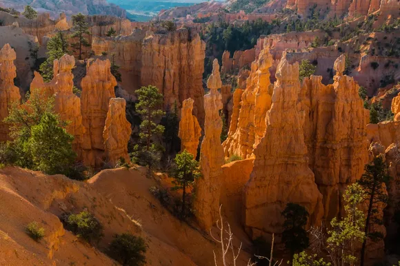
October brings cool mornings in the 40s and daytime highs in the 60s, perfect for walking without overheating. The summer crowds thin out after Labor Day, and by mid-October you'll find parking at the viewpoints without circling. The aspens on the plateau turn gold against the red rocks, and early morning light hits the hoodoos at an angle that makes them glow.
Mesa Verde National Park
Seven hundred Ancestral Pueblo dwellings / Most people have never heard of it
The Mesa Top Loop is a six-mile paved road with pullouts at a dozen archaeological sites, each one reachable by short, flat trails. You'll walk to the edge of cliff dwellings tucked into alcoves, peer into kivas, and stand where people lived 800 years ago. The sites are spaced close enough that you can see multiple dwellings in a single afternoon without covering serious mileage on foot.
Mesa Verde is the only national park where the architecture is the landscape, and the accessible trails put you close enough to see the fingerprints in the mortar.
Cliff Palace, the largest cliff dwelling in North America, requires a ranger-guided tour that involves climbing four 10-foot ladders, but Spruce Tree House offers a half-mile accessible overlook trail that gets you close enough to understand the scale. October is ideal here: the summer heat breaks, the aspens turn yellow on the mesa top, and the low-angle sunlight illuminates the alcoves without the harsh shadows of midday.
Carlsbad Caverns National Park
A limestone cavern beneath the Chihuahuan Desert / 400,000 bats at dusk
The Big Room Trail is a paved, mostly level loop that circles the largest single cave chamber in North America. You'll walk a mile and a quarter past formations that took millions of years to form, in a space so large it could swallow six football fields. The trail is entirely underground, which means the temperature stays at 56 degrees year-round, making October visits feel warmer than summer above ground.
The cavern was carved by sulfuric acid, not water, which explains why the formations look more like frozen waterfalls than dripping icicles.
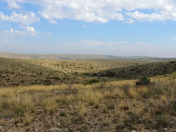
You can take an elevator 750 feet down to the Big Room entrance, skipping the Natural Entrance Trail entirely if you want to avoid the steep descent. The cavern's scale becomes clear when you realize the formations you're looking at from a distance are actually taller than buildings. By October, the bat flight season is winding down, but the crowds thin dramatically once summer tourism ends.
Saguaro National Park
Cacti older than the United States / Two districts flanking Tucson
The Cactus Forest Trail in the Rincon Mountain District is a paved two-and-a-half-mile loop through the densest stand of saguaros in the park. You'll walk among cacti that can reach 40 feet tall and weigh more than a car, many of them over 150 years old. The trail is wide, flat, and shaded in the early morning by the saguaros themselves, which is when you'll see the best light and the most wildlife.
October in the Sonoran Desert means daytime highs in the 80s and mornings cool enough to walk without feeling like you're standing on a griddle.
The Desert Discovery Trail in the Tucson Mountain District is a half-mile accessible loop with interpretive signs explaining how saguaros survive in a landscape that gets less than a foot of rain each year. You'll see barrel cacti, prickly pear, and ocotillo alongside the saguaros, and the trail offers views west toward the Tucson Mountains that turn purple at sunset.
Biscayne National Park
Miami's skyline on the horizon / The only living coral reef in the continental U.S.
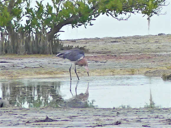
The Elliott Key Trail is a two-mile round trip on flat, packed earth through a tropical hardwood hammock, ending at a rocky shoreline where you can wade into Biscayne Bay. The trail is shaded by gumbo limbo trees and poisonwood, and you'll likely see raccoons, butterflies, and wading birds along the way. The key is only reachable by boat, which keeps the crowds light even during peak season.
Biscayne is 95 percent water, which means the accessible trails are short but the boat rides to reach them are part of the experience.
The Boca Chita Lighthouse Trail is a half-mile loop on a compact gravel path that circles the historic lighthouse and offers views across the bay to the Miami skyline. October is the start of dry season in South Florida, which means calmer seas, clearer water for snorkeling, and fewer afternoon thunderstorms that can strand you on an island.
Dry Tortugas National Park
Seven coral islands 70 miles west of Key West / A fort that was never finished or fired upon
The Fort Jefferson Trail is a mile and a half of flat brick walkways and gravel paths circling the massive hexagonal fort. You can walk the entire perimeter, climb to the second level for views across the islands, and peer into the cells where Dr. Samuel Mudd was imprisoned after the Lincoln assassination. The fort dominates Garden Key, and the trail requires no climbing beyond a few sets of stairs.
Fort Jefferson is larger than any coastal fort in the United States, built with 16 million bricks to protect a shipping channel that shifted before the fort was completed.
The Snorkel Reef Trail is an underwater path marked by signs just offshore from the fort's moat wall. You'll swim over brain coral, elkhorn coral, and seagrass beds where sea turtles graze. October offers the calmest seas of the year and water temperatures still in the low 80s, ideal for extended snorkeling without a wetsuit.
Everglades National Park
America's largest subtropical wilderness / A slow-moving river creating sawgrass marshes
The Anhinga Trail is a paved and boardwalked loop that delivers more wildlife per mile than almost any trail in the national park system. You'll walk half a mile through sawgrass marsh and cypress swamp, passing alligators sunning on the banks, anhingas drying their wings, and herons stalking fish in the shallows. The boardwalk puts you at eye level with the marsh, close enough to see the detail but elevated enough to stay dry.
The Anhinga Trail in October is what the Everglades was before drainage canals: water everywhere, wildlife concentrated at every bend, and birds so abundant you stop counting.
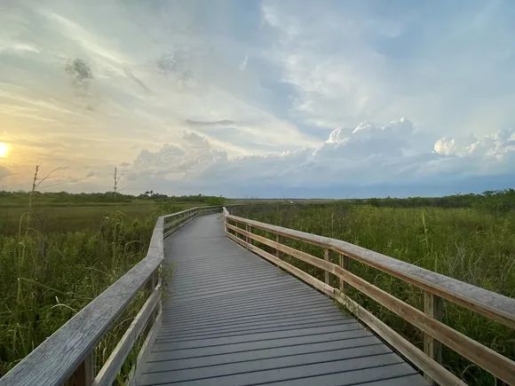
The Gumbo Limbo Trail is a shorter loop through a tropical hardwood hammock, shaded by gumbo limbo trees with their distinctive peeling red bark. October marks the start of dry season, when water levels drop and animals concentrate around the remaining pools, making wildlife sightings almost guaranteed.
Congaree National Park
The largest old-growth bottomland hardwood forest in the Southeast / Champion trees via elevated boardwalk
The Boardwalk Loop Trail is a two-and-a-half-mile elevated path through a floodplain forest that protects some of the tallest trees east of the Rockies. You'll walk past loblolly pines over 150 feet tall, bald cypress with knees rising from the swamp, and water tupelos wider than your arm span. The boardwalk keeps you above the seasonal flooding that nourishes this ecosystem, and interpretive signs explain why these trees survived when logging cleared almost everything else.
Congaree in October means the forest floor is dry enough to walk, the canopy is starting to turn color, and the mosquitoes have finally retreated.
The boardwalk is fully accessible, with gradual slopes instead of stairs and benches at regular intervals. You'll hear woodpeckers hammering at dead snags, see deer crossing the trail, and smell the rich decay of a forest that floods every few years. October is the driest month on average, which means you can extend your visit onto the dirt trails that branch off the boardwalk without needing waterproof boots.