8 national parks where paved paths lead to world-class views
Eight national parks where paved paths, boardwalks, and carriage roads lead to world-class landscapes
Most national park photography shows what you reach after the hard miles: summits you scramble to, waterfalls you bushwhack for, overlooks you earn. But some of the system's most compelling landscapes sit at the end of paved paths, accessible to wheelchairs, strollers, and anyone who measures their day in energy reserves rather than elevation gain.
These eight parks prove that accessibility and wilderness aren't opposing values. They're places where boardwalks cross alligator habitat, where carriage roads wind through granite mountains, and where thermal springs meet historic architecture without a single set of stairs in the way.
Everglades National Park
Bigger than Rhode Island / Wildlife viewing from pavement
The Anhinga Trail puts you three feet from alligators, wading birds, and the slow-moving sheet flow that defines South Florida. This half-mile boardwalk through Taylor Slough might be the best wildlife viewing in any national park, wheelchair accessible or not. You'll watch anhingas spear fish, herons stalk the shallows, and gators sun themselves close enough to count their teeth. The trail is packed during winter peak season, but the animals don't care about crowds.
Nowhere else can you watch an alligator from a boardwalk while a roseate spoonbill feeds ten feet away.
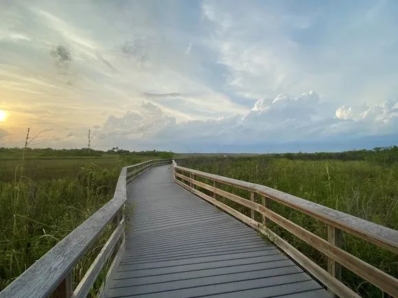
The adjacent Gumbo Limbo Trail loops through hardwood hammock on another paved path, this one shaded by strangler figs and live oaks. Both trails sit at Royal Palm, and together they make a case for winter in the Everglades that most visitors miss entirely. Come between December and April when water levels drop and wildlife concentrates along the remaining pools. Summer turns the park into a mosquito-infested steam bath that locals avoid.
Acadia National Park
45 miles of carriage roads / Draws more people than most states
John D. Rockefeller Jr. spent two decades building carriage roads through Acadia's forests, and he banned cars from every mile. The result is a network of crushed stone paths that wind past ponds, through tunnels under motor roads, and up to granite ridges overlooking the Atlantic. Jordan Pond Shore Trail circles the park's clearest water on level ground, with views of the Bubbles rising from the north shore. The loop is packed on summer weekends, but it delivers the postcard-perfect Acadia experience without technical terrain.
The carriage roads feel like a secret passageway through the park, even when the Loop Road is backed up for miles.
The Ocean Path runs two miles from Sand Beach to Otter Cliff along the rocky coast, close enough to the waves that storm surges occasionally close the trail. Thunder Hole sits halfway along the route, where incoming swells compress into a narrow chasm and explode upward with a boom you can feel in your chest. The path is fully paved and nearly flat, but it puts you in the middle of Acadia's defining landscape: pink granite meeting cold Atlantic water. Skip the sunrise crowd at Cadillac Mountain and watch the light change on the ocean instead.
Cuyahoga Valley National Park
20 miles of canal towpath / An hour from Cleveland
The Ohio & Erie Canal Towpath follows the route that mules once walked, pulling cargo boats between Lake Erie and the Ohio River. Today it's a level, paved trail through river bottomland, past beaver ponds, through covered bridges, and alongside the Cuyahoga River as it curves through the valley. You can ride or roll the entire 20-mile stretch within park boundaries, or pick shorter segments that connect to trailheads with parking. The towpath anchors the park's trail system, linking waterfalls, historic sites, and quiet stretches of forest that don't feel like they're surrounded by suburbs.
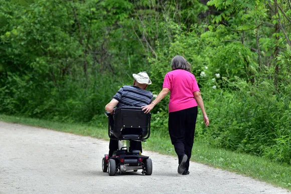
The towpath turns a linear park into a corridor you explore by bike or wheelchair, not from overlooks.
Brandywine Falls sits a quarter-mile from its parking area on a paved path that drops gently to a viewing platform. The 65-foot cascade drops over shale ledges into a hemlock-shaded gorge, and the platform puts you at eye level with the middle of the falls. It's one of the park's busiest spots, especially in fall when maples turn the gorge orange and yellow, but the viewing area is spacious enough to absorb the crowds. The park's accessibility extends to winter: cross-country skiers and snowshoers share the towpath with fat-tire bikes when snow covers the valley.
Shenandoah National Park
75 overlooks along Skyline Drive / Ridge-top views without the climb
Skyline Drive runs 105 miles along the crest of the Blue Ridge, and almost every major overlook has paved parking with accessible viewing areas. You can drive the entire park in an afternoon and catch sunset from multiple vantage points, each one offering layered ridges fading into Tennessee. The drive is the destination here, not a means to reach trailheads, and that makes Shenandoah one of the few parks where you can experience the core landscape without leaving pavement.
Skyline Drive threads through mountaintop meadows that were hardscrabble farms less than a century ago.

Limberlost Trail loops 1.3 miles through old-growth hemlocks on a crushed greenstone surface designed for wheelchairs. The path is wide, nearly flat, and shaded by trees that survived logging because the terrain was too steep for profitable harvest. Wildflowers line the trail in spring, and the forest floor stays cool even in July. The trailhead sits at milepost 43 on Skyline Drive, and it offers a rare chance to move through Shenandoah's forest interior on accessible ground. October brings the leaf-peeper crowds, but September offers the same ridgeline colors with half the traffic.
Carlsbad Caverns National Park
One elevator drops 750 feet / Cave temperature never changes
The Big Room sits 750 feet underground, and you can reach it by elevator without descending the switchbacks of the Natural Entrance Trail. Once you're down, the paved loop through the Big Room covers 1.25 miles of the largest single cave chamber in North America. Limestone formations hang from the ceiling and rise from the floor in shapes that look sculptured: draperies, columns, soda straws, and flowstone cascades lit by carefully placed fixtures. The path is nearly level, and the cave stays at 56 degrees year-round while the Chihuahuan Desert above bakes at 95.
The Big Room doesn't prepare you for its own scale: cathedral ceilings open into side chambers you could fit entire houses inside.
Carlsbad formed through sulfuric acid dissolution rather than the carbonic acid that creates most caves, and the chemistry produced formations you won't see elsewhere in the park system. The Big Room trail passes all the signature features, including the Rock of Ages, Giant Dome, and Bottomless Pit, with frequent benches and accessible restrooms at the midpoint. Most visitors skip the bat flight program, but 400,000 Mexican free-tailed bats spiral out of the Natural Entrance at dusk from May through October in a display that rivals anything underground.
Mesa Verde National Park
700 cliff dwellings / Ancestral Pueblo architecture 800 years old
Mesa Top Loop Road connects ten archaeological sites on a six-mile paved route, with parking and short walks to pit houses, pueblos, and cliff dwelling overlooks. You can see Square Tower House, Cliff Palace, and Sunset House from viewpoints that require minimal walking, all on stable surfaces. The road climbs through piñon-juniper woodland to the mesa top, where Ancestral Pueblo people farmed and built communities before moving into the alcoves below. Each stop includes interpretive signs explaining construction techniques, daily life, and the still-debated reasons for the late-1200s migration that left these structures empty.
Cliff Palace's 150 rooms sit in an alcove so precisely fitted to the architecture that it looks like the buildings grew from the stone.
The Chapin Mesa Archaeological Museum offers accessible exhibits on Pueblo culture, pottery, and the 1888 discovery that brought Mesa Verde to national attention. The museum sits at the heart of the park's developed area, with paved paths connecting to several overlooks and the start of ranger-led tours. While the most famous cliff dwellings require ladder climbs and crawling through tight passages, the viewpoints capture the dwellings' improbable locations and sophisticated construction. Spring and fall offer mild weather and fewer tour groups than June and July.
Indiana Dunes National Park
15 miles of Lake Michigan shore / More plant species than Yellowstone
West Beach offers accessible beach mats that roll wheelchairs across sand to the waterline, with accessible restrooms, parking, and a bathhouse at the trailhead. The beach sits between Gary's steel mills and Michigan City's port, but the dunes rise high enough to block industrial views and create the illusion of wilderness shoreline. Lake Michigan's water stays cold into July, but the beach fills with Chicago families escaping summer heat. The accessible mat system isn't perfect, but it's among the best in the park system for bringing mobility devices onto sand.
Lake Michigan's wind-built dunes hold over 1,100 plant species in an area smaller than Manhattan.
The Dunes Succession Trail makes a short loop on boardwalk and packed sand, showing how plant communities change from beach to dune to forest in a matter of yards. The trail packs an ecology lesson into less than a mile, and interpretive signs explain how marram grass stabilizes sand while cottonwoods pioneer the next stage inland. Porter Beach and Kemil Beach also offer accessible facilities, though summer weekends see parking lots fill by mid-morning. The park is packed from Memorial Day through Labor Day, but September brings warm water, smaller crowds, and the year's best beach weather.
Hot Springs National Park
143-degree thermal water / Bathhouse Row in downtown Arkansas
The Grand Promenade runs half a mile behind Bathhouse Row on a brick path built in 1930, connecting eight historic bathhouses where visitors once came to soak in thermal springs. The path is level, shaded by oaks, and lined with fountains where you can fill bottles with hot spring water cooled to drinkable temperature. Hot Springs is the only national park centered in a city, and the promenade puts you in the middle of that unusual overlap: wilderness thermal features meeting beaux-arts architecture on a downtown street.
Hot Springs democratized thermal bathing in the 1920s by building grand bathhouses that served everyone from senators to tuberculosis patients.
Bathhouse Row itself is fully accessible, with two bathhouses still offering thermal baths and several others converted to museums and visitor centers. The Fordyce Bathhouse operates as the park's main visitor center, and its restored interior shows marble tubs, stained glass, and the elaborate hydrotherapy equipment that once defined American spa culture. The park's trail system climbs into the surrounding Ouachita Mountains, but the core experience sits on level ground where thermal water still flows at 700,000 gallons per day.